


India Satellite Weather

Descrizione di India Satellite Weather
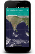
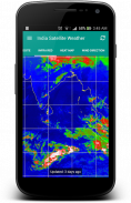
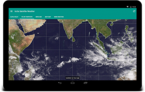
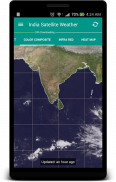
"Un'immagine vale più di mille parole". A dati meteo complessi possono essere trasmessi facilmente con una mappa immagine. Osservando le formazioni nube intorno alla vostra città, si può facilmente prevedere se il giorno sta per essere caldo o piovoso / nuvoloso.
E 'molto ben attrezzata con funzionalità di caching dei dati e non potrà mai scaricare i dati duplicati dal server. Le mappe meteo scaricate saranno memorizzate localmente e possono accedere offline.
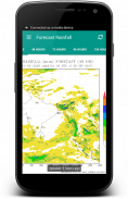
Questa applicazione recupera il tempo mappe direttamente da Indian Meteorological Department (www.imd.gov.in) e CIMSS [USA] (http://cimss.ssec.wisc.edu)
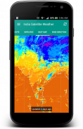
FYI: Io davvero non hanno il controllo sulla regione mancante a nord indiano di alcuni tipi di mappa, perché sono forniti da USA Meteorological Department.
Si tratta di un'applicazione open source: https://github.com/Shahul3D/IndiaSatelliteWeather
Sentitevi liberi di contribuire!
India Satellite Weather - Versione 5.0.6
(27-01-2020)
India Satellite Weather - Informazioni APK
Versione APK: 5.0.6Pacchetto: com.shahul3d.indiasatelliteweatherUltima versione di India Satellite Weather
Altre versioni


App nella stessa categoria


